


Railway infrastructure monitoring system based on Beidou positioning technology
-
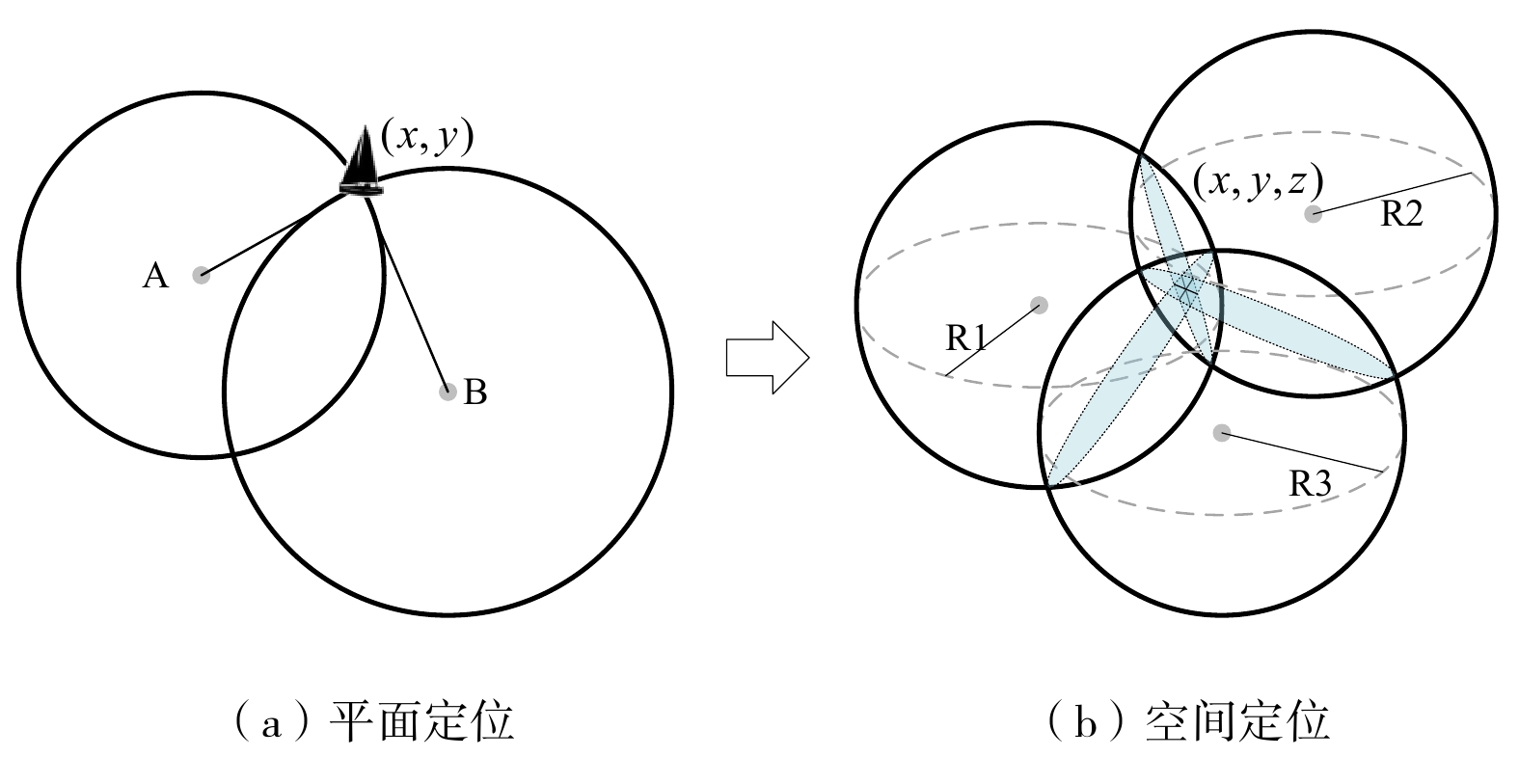
摘要: 近年来,为保障铁路运输安全,利用北斗高精度定位技术的铁路基础设施位移监测方法得到了广泛研究。文章介绍了北斗高精度监测的原理,详细阐述了基于北斗定位技术的铁路基础设施监测系统的架构、功能和接口设计,并通过现场监测数据对该系统的功能进行了验证,验证结果表明,该系统能够实现毫米级的监测精度,可为铁路基础设施位移监测提供技术支撑。Abstract: In recent years, in order to ensure the safety of railway transportation, the displacement monitoring method of railway infrastructure using Beidou high-precision positioning technology has been widely studied. This paper introduced the principle of Beidou high-precision monitoring, expounded in detail the architecture, function and interface design of the railway infrastructure monitoring system based on Beidou positioning technology, and verified the function of the system through on-site monitoring data. The results show that the system can achieve millimeter level monitoring accuracy, and can provide technical support for railway infrastructure displacement monitoring.
-
表 1 监测对象形变/位移趋势及巡检建议
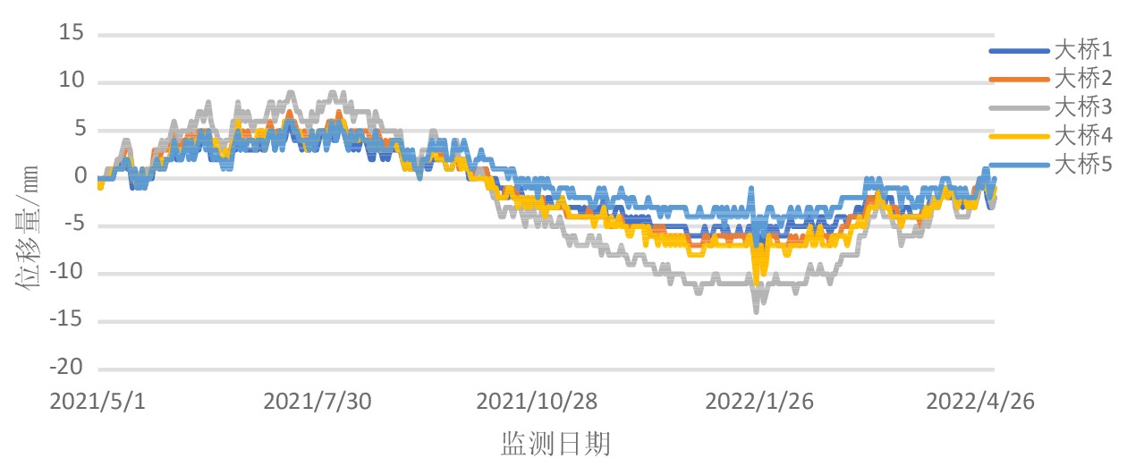
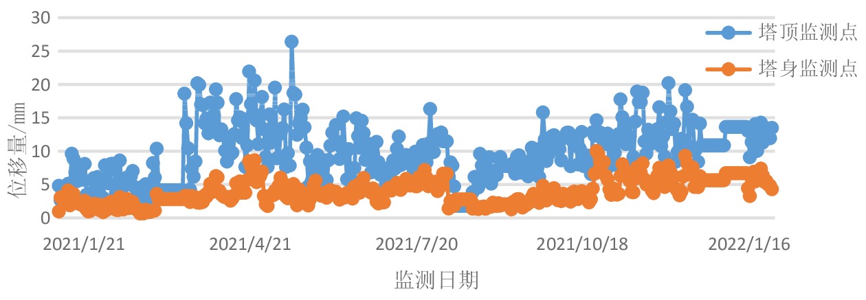
监测对象 形变/沉降趋势 巡检建议 高路堤边坡 存在明显沉降位移趋势,监测到最大沉降约10 mm,平均沉降约8 mm 按相关规定,对该工点进行检查,加固。 隧道仰坡 未监测到明显沉降趋势 按相关规定,定期巡检该工点,建议关注5号、8号监测点环境 桥梁 未监测到明显形变趋势 按相关规定,定期巡检该工点 基站通信铁塔 未监测到明显倾斜趋势 按相关规定,定期巡检该工点  下载: 导出CSV
-
[1] 王文文,李 勇,韩 征,等. 从T179次列车脱轨事故浅谈构建重大线性工程地质安全监测预警体系 [J]. 城市地质,2020,15(2):137-140. doi: 10.3969/j.issn.1007-1903.2020.02.003 [2] 段良伟. 京广高铁某路基变形成因与治理研究[D]. 南昌: 华东交通大学, 2021. [3] 刘艳亮,张海平,徐彦田,等. 全球卫星导航系统的现状与进展 [J]. 导航定位学报,2019,7(1):18-21,27. doi: 10.16547/j.cnki.10-1096.20190103 [4] 王 剑,周子健,姜 维,等. GPS/BDS联合解算的列车高精度实时定位方法 [J]. 交通运输工程学报,2021,21(5):286-296. doi: 10.19818/j.cnki.1671-1637.2021.05.024 [5] 秦 健. 基于北斗的铁路施工作业人员和车辆安全预警防护系统方案研究 [J]. 铁路计算机应用,2017,26(9):11-14. doi: 10.3969/j.issn.1005-8451.2017.09.003 [6] 刘 洋. EMD在北斗桥梁变形监测数据中的应用研究 [J]. 测绘与空间地理信息,2022,45(1):189-191,197. doi: 10.3969/j.issn.1672-5867.2022.01.048 [7] 路志远,潘佩芬,白雪娇,等. 铁路基础设施位移数据预测模型研究 [J]. 铁路计算机应用,2022,31(3):12-18. [8] Peng X Q, Gao J X, Wang J. Research of the coordinate conversion between WGS84 and CGCS2000 [J]. Journal of Geodesy and Geodynamics, 2015, 35(2): 219-221. [9] Opromolla R, Russo F, Fasano G, et al. Safe trajectory design and pose estimation for target monitoring in GEO [J]. Journal of Space Safety Engineering, 2019, 6(3): 188-196. doi: 10.1016/j.jsse.2019.07.001 [10] 陈树新. GPS整周模糊度动态确定的算法及性能研究[D]. 西安: 西北工业大学, 2002. [11] 祝会忠,李 军,徐爱功,等. 灾害应急环境下智能终端高精度北斗增强定位方法 [J]. 武汉大学学报·信息科学版,2020,45(8):1155-1167. doi: 10.13203/j.whugis20200123


 点击查看大图
图(7) / 表(1)
